Sacramento Rim Roller
November 2nd, 2024
Joe Myers
is the coordinator for this ride.
He will handle any proposed route changes,
pre-rides, ride day sign-in/sign-out, etc.
Thanks Joe !!!
is the coordinator for this ride.
He will handle any proposed route changes,
pre-rides, ride day sign-in/sign-out, etc.
Thanks Joe !!!
This is fully unsupported and you will need to be self-sufficient in order to complete.
Please make sure to read all rules for this ride.
The rules are located HERE.
No more than 74 people allowed for this ride!
When: November 2, 2024
- A & B Course:
|
131 Burro Ave
Cloudcroft, NM 88317 Meet at the dirt parking area on the far West end of Burro Ave, just beside Cloudcroft Baptist Church |
What: Epic Mountain Bike Endurance Rides of:
- A Course: 52 miles, with 6.6K feet of climbing
- B Course: 40 miles, with 5.0K feet of climbing
GPS Tracks:
- No warranty, express or implied, use at your own discretion.
- Garmin users can download directly into their supported devices from the Garmin Connect pages below. Be sure to a test “Do course” to make sure the track downloaded properly.
- You can also export the track to GPX from these pages, load into TopoFusion and then download to your GPS. Use this option for non Garmin users and those that above option dosen’t work.
| |||||
- Go here to convert to other GPS formats
- Go here to download TopoFusion PRO Free/Demo
SAG Drop Information:
The SAG drop will be located at the NE side of the intersection of Benson Ridge Rd and Sunspot Hwy (mile 26.9). A-course riders can also resupply at your car in Cloudcroft before continuing on the final 12 miles of the A course. All drop bags and contents must be disposable, i.e. no one will be bringing it back to you so don’t put in anything you must have back. Someone will be doing the clean-up, and will keep any goodies for their troubles and will throw away the rest.
The SAG drop will be located at the NE side of the intersection of Benson Ridge Rd and Sunspot Hwy (mile 26.9). A-course riders can also resupply at your car in Cloudcroft before continuing on the final 12 miles of the A course. All drop bags and contents must be disposable, i.e. no one will be bringing it back to you so don’t put in anything you must have back. Someone will be doing the clean-up, and will keep any goodies for their troubles and will throw away the rest.
After the ride:
We'll start and end at the same parking area as before (west end of Burro Ave), but after the ride, we'll meet for food and beers at the new Cloudcroft Brewery, at the east end of Burro Ave (1301 Burro Ave). Good beer, great pizza, and owned by local biker and High Altitude owner Matt Willett! Their parking is a bit limited so I don't want us to be parking there all day.
Maps:
Fairly decent maps covering most of the trails (all but Goodsell Rd/Chippeway Trail and Thousand Mile Canyon) are available online: Also, there’s the Lincoln National Forest, Smokey Bear and Sacramento Ranger Districts map. Kinda big, but it’ll do the job. Most outdoor recreation stores carry it, or you can order it at:
Sacramento Rim Roller, A & B Course
| srr_-_a_cue_sheet.docx |
| srr_-_b_cue_sheet.docx |
Course notes:
- We have a new A course! This year everyone will start by riding the B course. When you get back to Cloudcroft, A-course riders will continue on a 12 mile loop which will start with the High Altitude Classic race course and finish by climbing the Trestle Trails. This is easier and less remote than the previous A course, and better suited to the kinder, gentler, politically correct new NMES.
- Due to the nature of these courses (mostly easy-to-follow trails with well-marked intersections), the course descriptions here will enable most riders to follow them with only a reliable cycle computer. A GPS will still be helpful in a few places.
- Don’t be fooled… this may be southern New Mexico, but it’ll be November and much of the riding is above 9000 feet. Be prepared for a cold start and unpredictable weather. And don’t forget the short days; you may want to bring lights.
- There are six bailout options on the 11 miles of the Rim Trail we’ll be riding, providing access to the Sunspot Hwy. Having a map and knowing these bailouts might be helpful.
- There are a few gates on the course; whether open or closed, leave them as you find them.
Remember: Your mileage may vary a little so keep your head up.
- Head East on Burro Ave, turn right on Curlew Pl (in front of the Western Bar).
- Mile 0.1 Cross US 82, continuing on Curlew Pl.
- Mile 0.3 Turn right on Sunset Blvd (dirt), which eventually turns back into Curlew Pl.
- Mile 0.9 Turn right on Corona Ave. Follow Corona Ave a short distance, staying right at Switchback Ln (follow the Dead End sign).
- Mile 1.1 Go around the green pipe gate and onto a broad, easy singletrack.
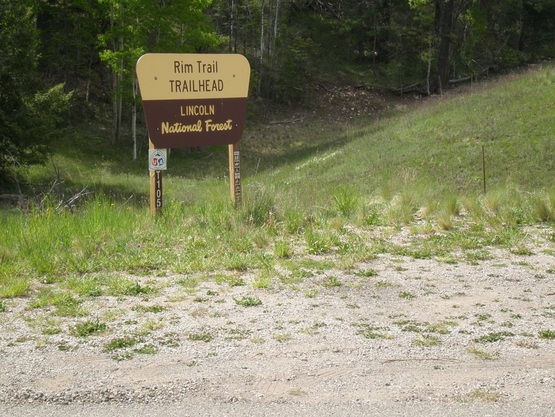
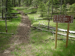
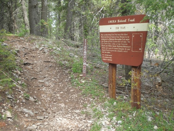
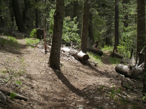
- Mile 1.5 Cross the road and pick up the Rim Trail (T105). You’ll roll through a tunnel under NM 130 and parallel the road for a bit. Enjoy the Rim Trail for the next 7.4 miles.
- Mile 2.2 Bear right on T105, avoiding the gate to the parking area. You’ll soon pass a campground; stay outside the fence to continue on T105.
- Mile 6.7 Jog right as you cross FR 636 to continue on T105.
- Mile 7.8 Stay right on T105 (left is a bailout to Sunspot Hwy).

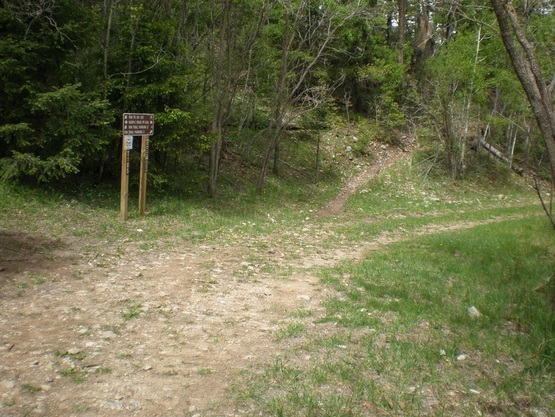
- Mile 8.9 Leave T105 here by turning left and climbing up to Rim Trail parking #4.
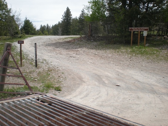
- Mile 9.0 Go through the gate and jog right as you cross Sunspot Hwy onto Russia Canyon Rd. As soon as you cross the cattle guard, turn left onto Goodsell Rd (FR 623). Stay on FR 623 for the next 5.4 miles.
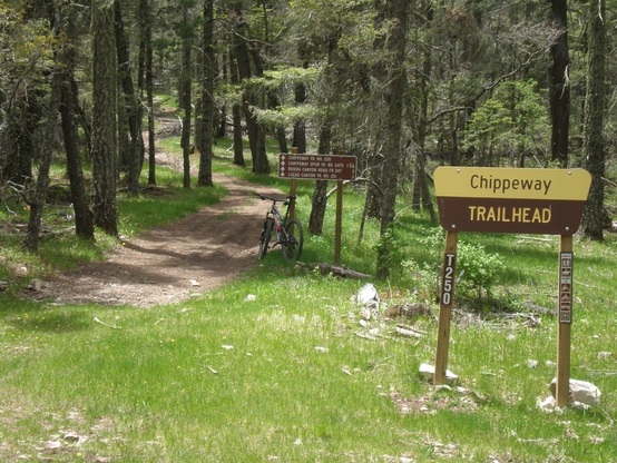
- Mile 14.5 Turn right on Chippeway Trail (T250).
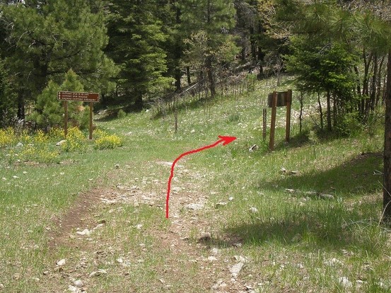
- Mile 16.2 Turn right up a short rocky climb to continue on T250. The trail gets a bit indistinct through here; your GPS will be helpful.
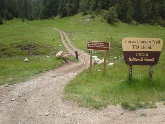
- Mile 17.6 Cross Russia Canyon Rd and start up Lucas Canyon Trail (T251).
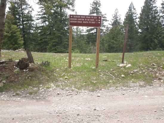
- Mile 22.7 Turn right on Benson Ridge Rd (FR 223).
- Mile 26.9 Benson Ridge Rd intersects Sunspot Hwy. The SAG drop is on the NE corner. Cross Sunspot Hwy onto Alamo Peak Rd (FR 64D, a one-lane paved road).
- Mile 27.6 Turn right onto T105. You’re back on the Rim Trail for the next 11 miles.
- Mile 28.2 Cross Karr Canyon Rd (FR63) and up the rocky ramp to continue on T105.
- Mile 29.4 Cross FR 634, staying on T105.
- Mile 31.0 Stay left on T105.
- Mile 31.4 Stay left on T105. This is where you left the Rim Trail on the way out; now you’ll backtrack all the way back to Cloudcroft. Following the Rim Trail should be obvious by now.
- Mile 38.8 After riding back through the tunnel under NM 130 and up to the Rim Trail trailhead, cross the road and pick up the easy singletrack (marked T105 here) that takes you to the green pipe gate and onto Corona Ave.
- Mile 39.5 Turn left on Curlew Pl (dirt), which turns into Sunset Blvd.
- Mile 40.1 Turn left back onto Curlew Pl (paved). Ride down, cross US 82, up to Burro Ave, and left back to your car.
- Mile 40.4 B-course riders, you are done! Sign out on the clipboard on Rich’s windshield, load up and drive east on Burro Ave ¾ mile to Cloudcroft Brewery for beer and pizza!
A-course riders: after resupplying at your car, ride east on Burro Ave to Mescalaro Ave. - Mile 40.5 Turn left on Mescalaro Ave.
- Mile 40.8 Turn right on the two-track across from the land fill, then an immediate right on the singletrack.
- Mile 42.1 Turn right on the two-track and through the v-gate. Roll through the Pines Campground and exit through another v-gate. Back on singletrack.
- Mile 42.8 This trail spits you out at the intersection of FR206c and FR568. Go mostly straight (NOT DOWN) to pick up FR568 (not marked). Follow this mellow dirt road for about a mile, through a narrow gate, and to the edge of a large meadow.
- Mile 44.1 Turn left to start down an unmarked singletrack.
- Mile 46.1 After you pop out onto a dirt road, ride down a couple hundred yards and turn right up a short rocky climb to Bailey Canyon Rd. At the top, turn right, then a quick left onto the Switchback Trail (T5004).
- Mile 48.6 Cross the pedestrian bridge, down the stairs, and start up the Old Cloudcroft Hwy.
- Mile 48.9 Stay left; avoid the straight trail up Toboggan Canyon.
- Mile 50.2 Cross a small creek and turn left just before the trail shelter. Switchback up the Trestle Trails.
- Mile 51.4 Turn left and up. When this trail tops out, go right and down to US 82. Cross the highway and back to your car.
- Mile 51.8 You are done! Sign out on the clipboard on Rich’s windshield, load up and drive east on Burro Ave to Cloudcroft Brewery. See if the B riders left you any beer.
